Why UAV Safety Rules Matter More Than Ever
Flying unmanned aerial vehicles (UAVs), more commonly known as drones, has become an essential part of modern life, powering everything from aerial photography and construction surveys to agriculture and emergency response. But as drones become more widespread, so does the responsibility of flying them safely and legally. In the USA, the Federal Aviation Administration (FAA) […]
Impact of DJI Legal Action in the U.S. and its Impact in the Caribbean
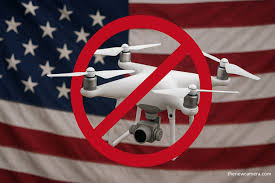
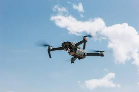
DJI is actively challenging the U.S. import ban because the Federal Communications Commission (FCC) placed the company on its “Covered List,” blocking authorization and importation of all new DJI drone models and critical components. The restriction took effect on December 23, 2025, and prevents DJI from bringing any new devices into the U.S. market. DJI […]
Unlocking value for the Caribbean UAV market with Remote ID
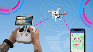
Remote ID, often described as a “digital license plate” for drones, is becoming a cornerstone of safe and regulated UAV operations worldwide. For the Caribbean, where drones are increasingly used in agriculture, disaster response, tourism, and infrastructure monitoring, Remote ID offers both practical and strategic value. By broadcasting a drone’s identity and location in real […]
Impact of the DJI Ban on the Caribbean Drone Market

The recent U.S. ban on DJI, the world’s largest UAV (drone) manufacturer, is sending ripples across the Western Hemisphere’s growing drone industry. DJI, which holds a dominant share of the global market, has been restricted in the United States due to their Government’s concerns about national security, with several U.S. agencies citing risks tied to […]
Why Caribbean Seafaring nationals need to be aware of “at sea” UAV activities.
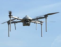
A recent Searchlight report has intensified regional concern over the growing presence of foreign military operations in Caribbean waters. According to Commander Deon Henry of the St. Vincent and the Grenadines Coast Guard (SVGCG), local fishers operating near Fish Aggregating Devices (FADs) were close to a U.S. military drone strike that allegedly killed three St. […]
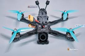
Caribbean Creators Eye Drone Swarm Shows
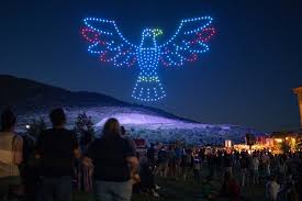
Drone swarm shows—synchronised aerial performances using multiple drones—are becoming a global spectacle, and Caribbean creators are well-positioned to explore this emerging art form. With vibrant cultural festivals, tourism events, and national celebrations, the region offers ideal stages for dazzling drone choreography. To begin, creators should consider scale. Small shows can be staged with 20–50 drones, […]
The Caribbean’s Potential for Regional UAV Development
The global drone industry is undergoing rapid change, with U.S. restrictions on foreign-made drones highlighting the risks of overreliance on external suppliers. For the Caribbean, this moment presents a unique opportunity: to invest in building drones tailored to regional needs. Caribbean companies could leverage local expertise in engineering, software development, and renewable energy to design […]
FCC UAV Ban and it Implications for the Caribbean
The U.S. Federal Communications Commission (FCC) has announced a ban on the sale of new foreign-made UAVs, citing national security concerns. The decision primarily affects Chinese manufacturers such as DJI, which dominate the global drone market. The FCC argues that foreign UAVs could pose risks by transmitting sensitive data to overseas servers, making them unsuitable […]
UAVs Industry Trends for 2026
The UAV industry in 2026 is expected to undergo a major transformation, driven by AI-powered autonomy, stricter regulations, and expanding commercial applications across agriculture, infrastructure, and emergency response. Analysts forecast UAVs shifting from simple observation tools to predictive and preventive systems, reshaping industries worldwide.Here are the trends to watch in 2026. In conclusion, 2026 is […]
A Caribbean drone wall? Will it work?
The concept of a ‘drone wall’ encircling the Caribbean may sound like a bold defence strategy, but it’s wildly impractical. With many islands scattered across vast maritime space, the logistics of building and maintaining a continuous aerial barrier are staggering. Unlike landlocked regions with defined borders, the Caribbean’s open skies and fluid airspace make a […]